
The NASA released satellite images that help measure the destruction caused by the earthquakes that hit northern Venezuela on June 24.
The records were obtained by Sentinel-1 satellites and analyzed by comparing images taken before and after the earthquakes. The survey made it possible to identify areas with a greater probability of damage in cities such as Caraballeda, Macuto, Naiguatá, La Guaira and Catia la Mar, which are among the most affected regions.
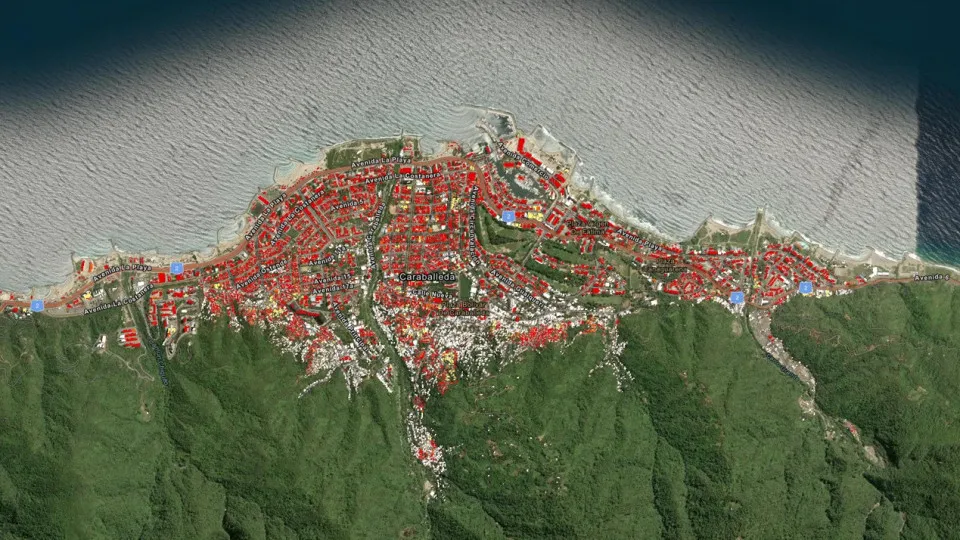
The map created using the Earthdata GIS program shows, in red, the structures most likely to have been damaged. In yellow, buildings with a lower probability of destruction appear. It is estimated that almost 59,000 buildings have been affected in northern Venezuela.
According to preliminary estimates cited by the United Nations Development Program (UNDP), material damage caused by earthquakes could reach US$6.7 billion.
The tremors caused heavy destruction along the central coast and in the metropolitan region of Caracas. According to the most recent official report, at least 1,450 people died and 3,150 were injured.
Itamaraty confirmed the deaths of two Brazilians as a result of the earthquakes and reported that it provides consular assistance to the families of the victims. To date, there is no official report on missing Brazilians.
According to the UN, more than 50 thousand people are still missing in Venezuela.
Source: www.noticiasaominuto.com.br
Source link